
How to Navigate a Wilderness Trail: Using Maps, Compass, and Landmarks
Exploring the wilderness can be a thrilling and rewarding experience, but it can also be dangerous without proper navigation skills. Knowing how to use maps, compass, and landmarks can mean the difference between getting lost and reaching your destination safely. As a professional hiker and experienced wilderness explorer, I have had my fair share of getting lost and found my way back using these navigation tools. In this article, I will share with you my personal experience and tips on how to navigate a wilderness trail using maps, compass, and landmarks.
Why Proper Navigation is Crucial
Getting lost in the wilderness is not only frustrating but can also be life-threatening. Without proper navigation skills, you can easily wander off-trail, lose your bearings, and end up in a dangerous situation. Proper navigation skills are crucial for any wilderness explorer, whether you are hiking, camping, or backpacking.
Tools for Navigation
The three essential tools for navigation are maps, compass, and landmarks. A map provides a visual representation of the terrain, while a compass helps you determine direction. Landmarks, on the other hand, are natural or man-made objects that can help you find your way.
- Map: A map is a two-dimensional representation of the terrain. It shows the topography, trails, and other features of the area.
- Compass: A compass helps you determine direction and navigate through the terrain.
- Landmarks: Landmarks can be natural features such as mountains, rivers, or man-made objects such as buildings, cairns, or trail markers.
In the next sections, we will discuss how to use these tools to navigate a wilderness trail.
Why is Navigation Important on a Wilderness Trail?
Navigation is one of the most critical skills any hiker or backpacker should possess. When you are out in the wilderness, miles away from civilization, navigation becomes a matter of life and death. A wrong turn or a missed trail junction can lead you to get lost, and it can take days for search and rescue teams to find you. That’s why navigation is vital on a wilderness trail.
Prevent Getting Lost
The primary reason for navigation is to prevent getting lost. Even experienced hikers can get lost in the wilderness. Without proper navigation skills, it’s easy to become disoriented and lose track of your location. When you know how to navigate, you can use maps, compass, and landmarks to stay on track and avoid getting lost.
Stay Safe
Navigation skills are essential for staying safe on a wilderness trail. When you know where you are going, you can avoid dangerous areas such as steep cliffs, rocky terrain, and areas prone to flash floods. You can also plan your route to avoid getting stuck in the wilderness overnight, which can be dangerous, especially if you are not prepared for it.
Save Time and Energy
Navigation skills can help you save time and energy on a wilderness trail. When you know where you are going, you can plan your route to avoid unnecessary detours and backtracking. This can help you conserve your energy and reach your destination faster. It can also help you avoid wasting time trying to find your way back to the trailhead.
Conclusion
Navigation skills are essential for any hiker or backpacker who wants to explore the wilderness safely and confidently. By using maps, compass, and landmarks, you can prevent getting lost, stay safe, and save time and energy. With proper navigation skills, you can enjoy your wilderness adventure to the fullest.
Understanding Maps: An Essential Skill for Wilderness Navigation
Maps are an essential tool for navigating a wilderness trail. They provide a visual representation of the landscape, helping you understand the terrain, locate landmarks, and plan your route. In this section, we’ll explore the different types of maps and their features.
Types of Maps
There are several types of maps that are commonly used for wilderness navigation. These include:
- Topographic Maps: These maps show the contours of the terrain, indicating changes in elevation. They also include features such as rivers, lakes, and forests.
- Aerial Maps: These maps use satellite imagery to provide a detailed view of the landscape. They can be helpful for identifying landmarks and features.
- Nautical Maps: These maps are designed for use on water and show the depths of bodies of water, as well as features such as buoys and lighthouses.
Map Features
Regardless of the type of map, there are several key features that you should be familiar with:
| Feature | Description |
|---|---|
| Scale | Indicates the relationship between the size of the map and the actual size of the terrain. |
| Legend | Explains the symbols and colors used on the map. |
| Contour Lines | Show changes in elevation. |
| Landmarks | Identify prominent features such as mountains, lakes, and buildings. |
| Compass Rose | Indicates the orientation of the map. |
Understanding maps and their features is critical for wilderness navigation. By familiarizing yourself with the different types of maps and their features, you’ll be better equipped to plan your route and stay on course.

Using a Compass
A compass is an essential tool for navigating a wilderness trail. It helps you determine your direction of travel and ensures that you stay on course. Here are the basic parts of a compass:
| Part | Description |
|---|---|
| Baseplate | A clear plastic base used for orienting the map. |
| Compass housing | The circular housing that contains the magnetic needle and orienting arrow. |
| Magnetic needle | A thin metal needle that rotates and points to magnetic north. |
| Orienting arrow | A fixed arrow that can be rotated to align with the map’s north-south grid lines. |
| Direction-of-travel arrow | An arrow that points in the direction you are traveling. |
| Index line | A line on the compass housing that aligns with the magnetic needle. |
Orienting the Map with a Compass
Before you can use your compass to navigate a wilderness trail, you need to orient the map. This means aligning the map’s north-south grid lines with the compass’s orienting arrow. Here’s how to do it:
- Place the compass on the map with the baseplate’s edge along the bottom edge of the map.
- Rotate the compass housing until the orienting arrow is pointing to true north (you can use the declination diagram on the map to adjust for magnetic declination).
- Rotate the map and compass together until the magnetic needle is aligned with the index line on the compass housing.
- The map is now oriented, and you can use the compass to determine your direction of travel.
Remember to keep the direction-of-travel arrow pointing in the direction you want to go and follow your route on the map to ensure that you stay on course.
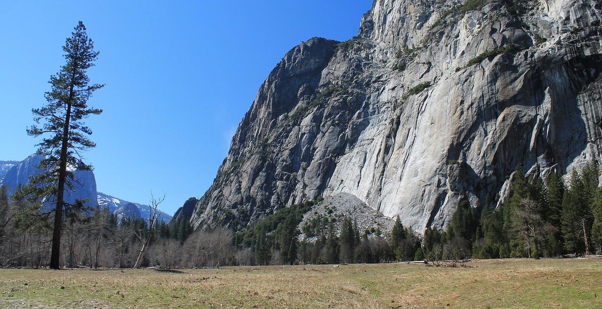
Identifying Landmarks
Landmarks are a crucial component in navigating a wilderness trail. They serve as reference points to help hikers determine their location and direction. In this section, we will discuss the two types of landmarks: natural and man-made.
Natural Landmarks
Natural landmarks are features in the environment that are not created by humans. They can include mountains, rivers, lakes, trees, and rock formations. These landmarks can be easily identified by their unique characteristics and can serve as reliable reference points for navigation.
- Mountains: Mountains are the most prominent natural landmarks. They are easily identifiable and can provide hikers with a sense of direction. When using a map, hikers can identify the location of a mountain and use it to orient themselves.
- Rivers and Lakes: Bodies of water are also reliable natural landmarks. They can provide hikers with a general sense of direction and can be used to identify their location on a map.
- Trees and Rock Formations: Trees and rock formations can also serve as natural landmarks. They are easily identifiable and can provide hikers with a sense of direction and location.
Man-Made Landmarks
Man-made landmarks are features in the environment that are created by humans. They can include buildings, bridges, roads, and other structures. These landmarks can be useful for navigation, but they may not be as reliable as natural landmarks as they can change over time.
- Buildings: Buildings are easily identifiable and can serve as reference points for navigation. However, they may not be as reliable as natural landmarks as they can be demolished or renovated.
- Bridges and Roads: Bridges and roads can also serve as man-made landmarks. They are useful for navigation as they can provide hikers with a sense of direction and location.
When navigating a wilderness trail, it is important to identify both natural and man-made landmarks. This will help hikers determine their location and direction and ensure they stay on the right path.
Putting it All Together
When navigating a wilderness trail, it’s important to use a combination of tools to ensure you stay on track. By using maps, a compass, and landmarks, you can confidently navigate your way through the wilderness.
Step 1: Plan Your Route
Before you set out on your hike, make sure you have a detailed map of the area you’ll be exploring. Study the map and plan your route carefully, taking note of any landmarks or features that will help guide you along the way.
Step 2: Use Your Compass
Once you’re on the trail, use your compass to orient yourself and determine which direction you need to go. Take note of any changes in direction and use your compass to ensure you’re staying on course.
Step 3: Look for Landmarks
As you hike, keep an eye out for landmarks such as distinctive trees, rock formations, or bodies of water. These landmarks can help you stay on track and provide valuable reference points as you navigate the trail.
Step 4: Stay Alert
Finally, it’s important to stay alert and aware of your surroundings at all times. Pay attention to changes in the terrain, weather conditions, and any other factors that may affect your navigation. By staying alert and using all of the tools at your disposal, you can safely and confidently navigate even the most challenging wilderness trails.
Summary
- Plan your route carefully using a detailed map
- Use your compass to orient yourself and stay on course
- Look for landmarks to guide you along the way
- Stay alert and aware of your surroundings at all times
| Tools | Advantages | Disadvantages |
|---|---|---|
| Maps | Provide a detailed overview of the area | May not always be up-to-date |
| Compass | Allows for precise navigation | Requires some skill to use effectively |
| Landmarks | Easy to identify and use as reference points | May not always be present or visible |